For my Design Studio course, I had to complete an analysis of the topography of Temple University Ambler’s Campus. To start off, I made some maps… Here are some of the results of my experimentation!
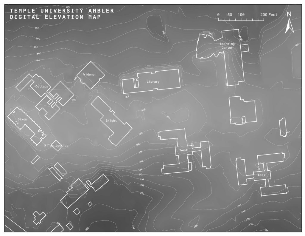
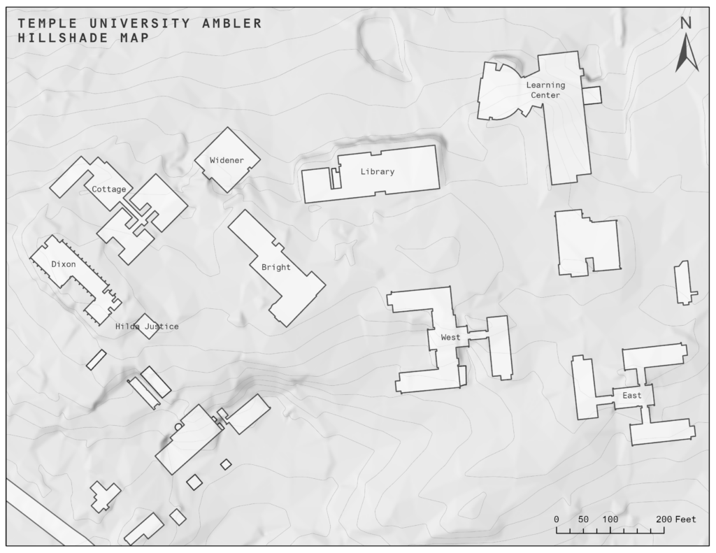
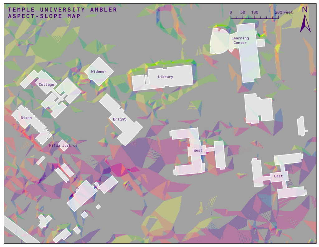
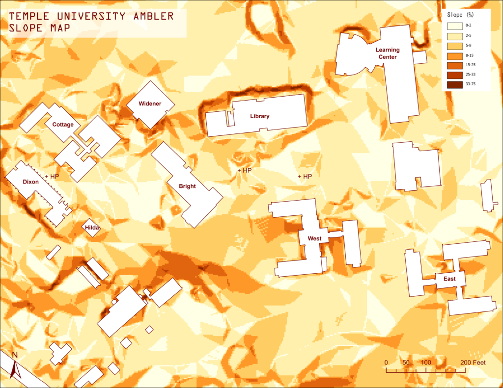

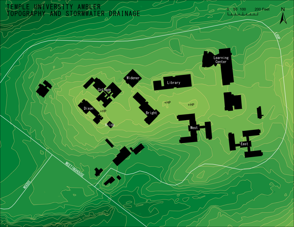
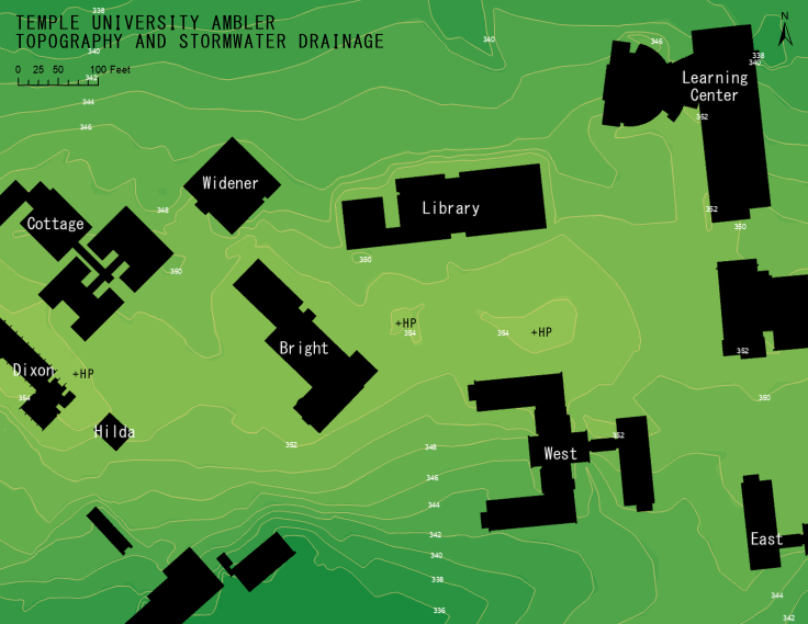
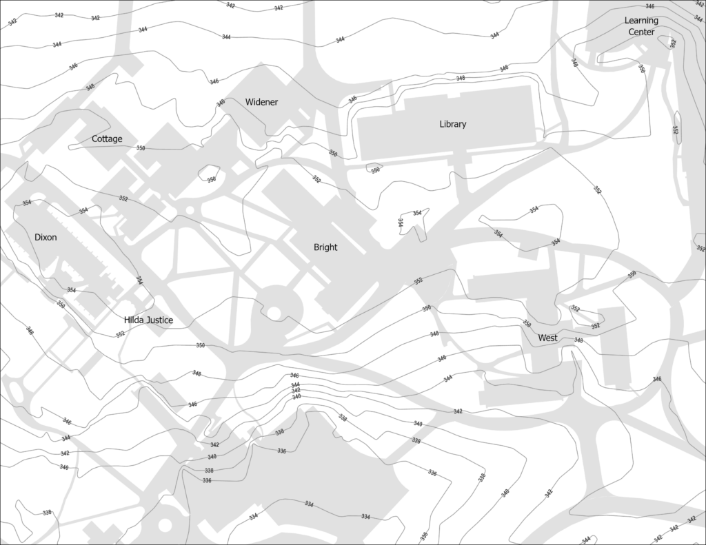
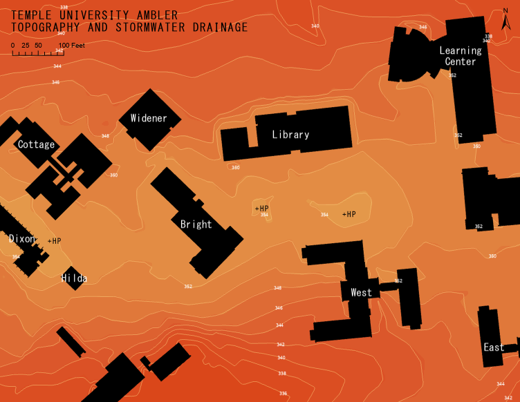
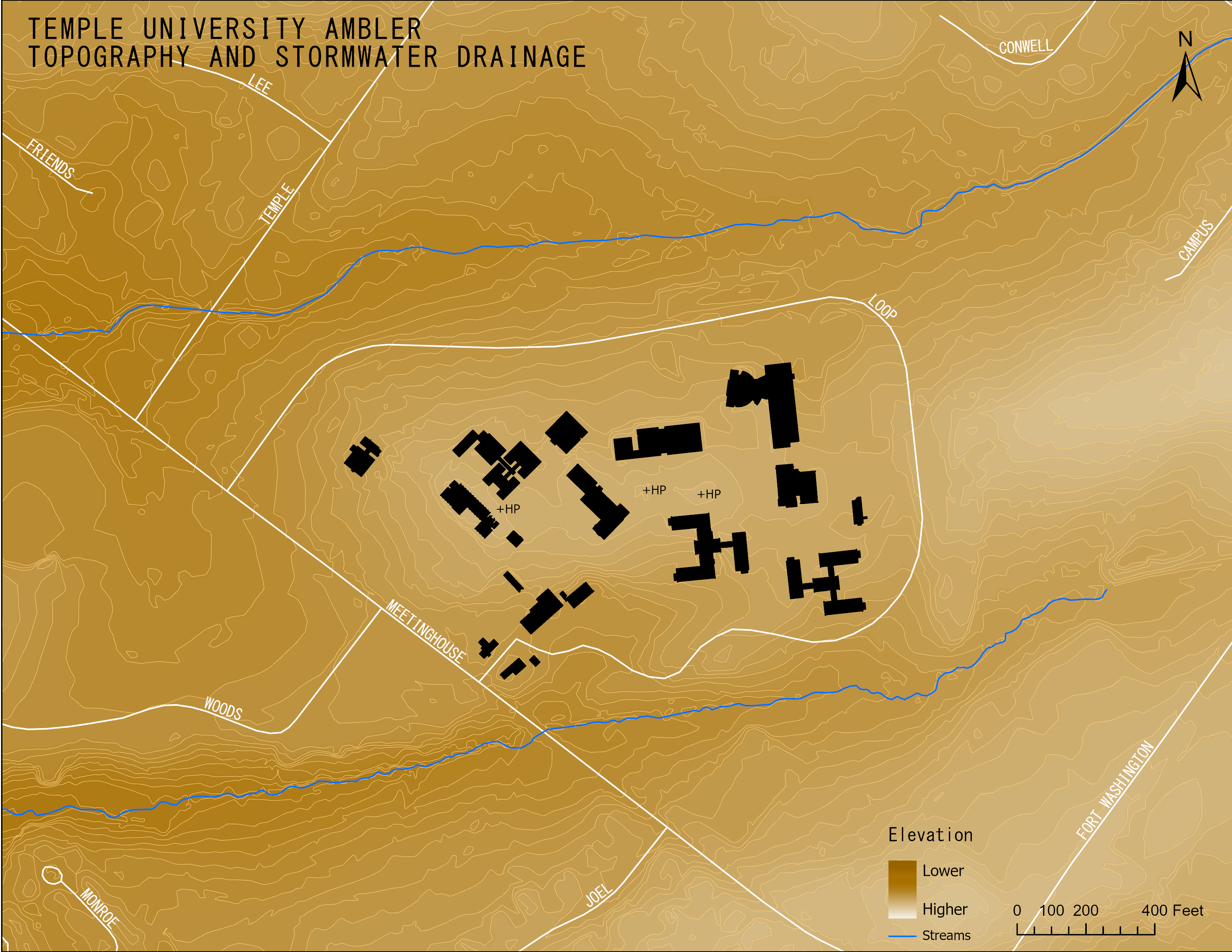
For my Design Studio course, I had to complete an analysis of the topography of Temple University Ambler’s Campus. To start off, I made some maps… Here are some of the results of my experimentation!