

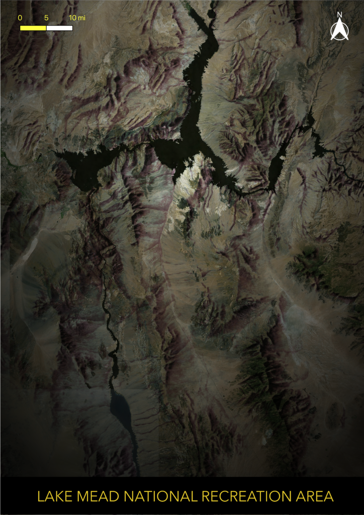
I created this visualization in QGIS for fun. I loosely followed this tutorial: https://www.esri.com/arcgis-blog/products/arcgis-pro/mapping/how-to-make-this-vintage-map-poster-of-yellowstone/
The process involved georeferencing and overlaying a vintage shaded relief tif (http://www.shadedreliefarchive.com/) over modern satellite imagery. I then created a singleband pseudocolor palette that allowed much of the satellite image to come through while emphasizing the mountainous parts of the relief tif with blacks, purples, and yellows. I also added a vignette to add a vintage effect.