
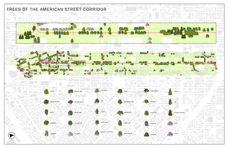
I created this map to showcase different tree species located in the American Street corridor.
Author: casemitch
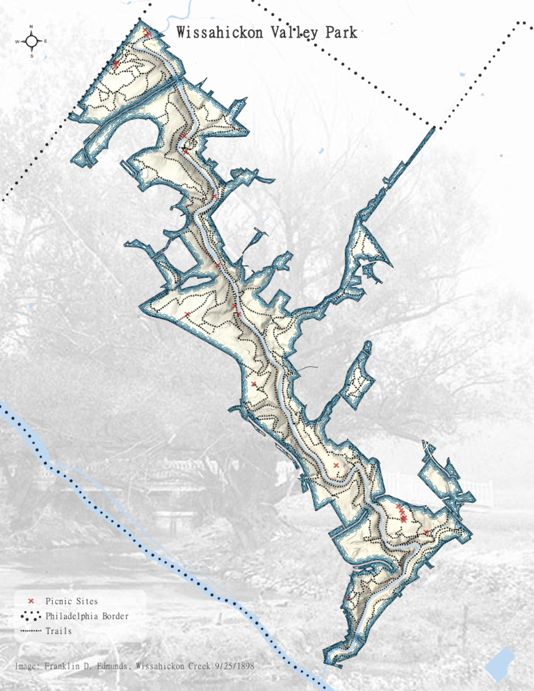
Wissahickon Valley Park
I created this map of the Wissahickon Valley Park as an exercise in ArcPro.
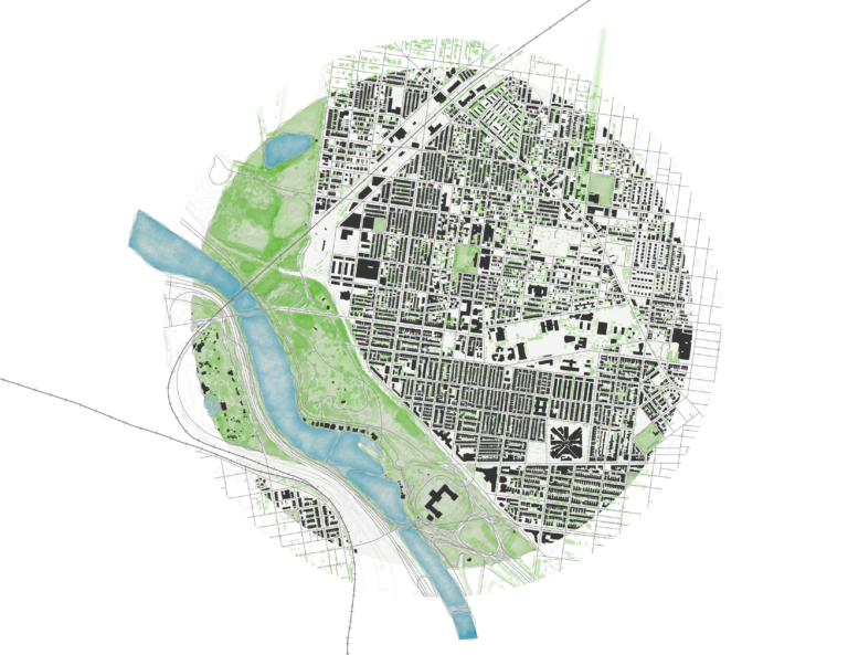
Fairmount Map
I created this map of the Fairmount/Brewerytown neighborhood in Philadelphia using ArcPro and John Nelson’s watercolor theme.
Design Studio Final Portfolio
This can also be viewed in its more proper book form on Issuu by clicking here.
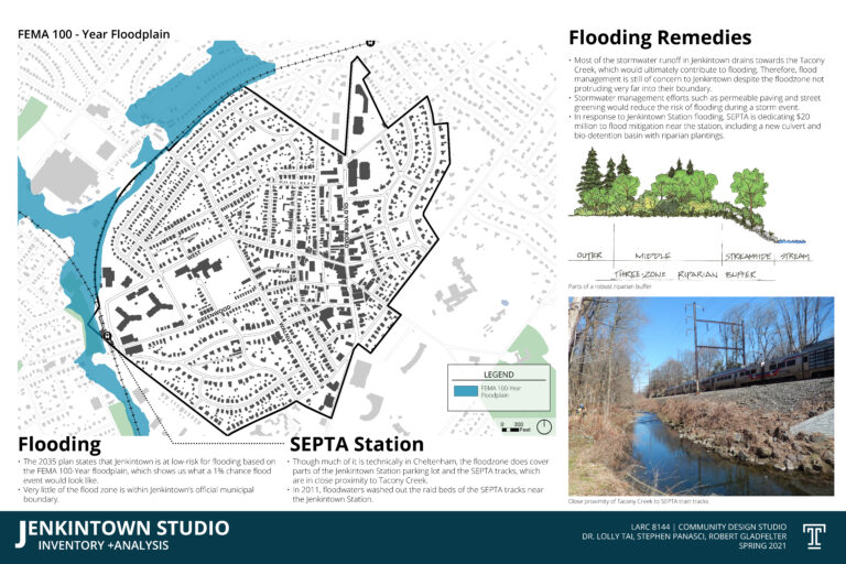
Jenkintown Inventory and Analysis
My inventory and analysis of the existing conditions in Jenkintown for my Community Design Studio course. This was done prior to completing my design for […]
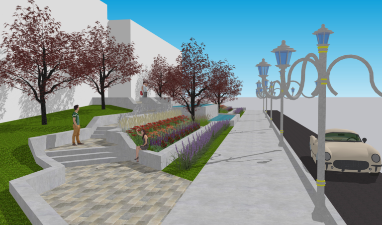
Plaza Project
This project for my computer design course allowed us to visualize our plans for a proposed plaza in CAD, Sketchup, and Photoshop.
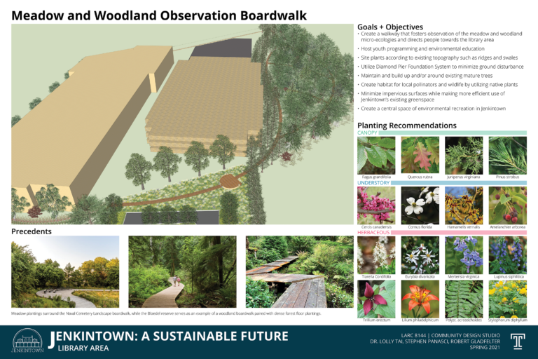
Jenkintown Design Project
This is my final project for my Community Design Studio course. It features a new ecologically-based design for the Jenkintown library. Download below for better […]
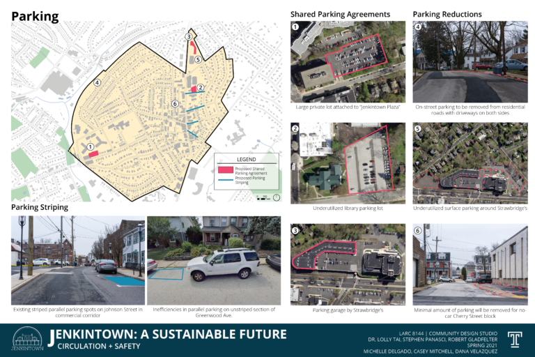
Jenkintown Circulation Analysis
An analysis of the existing pedestrian and vehicular circulation, public transportation, and bike routes in Jenkintown, PA with some recommendations. Download below for better legibility.
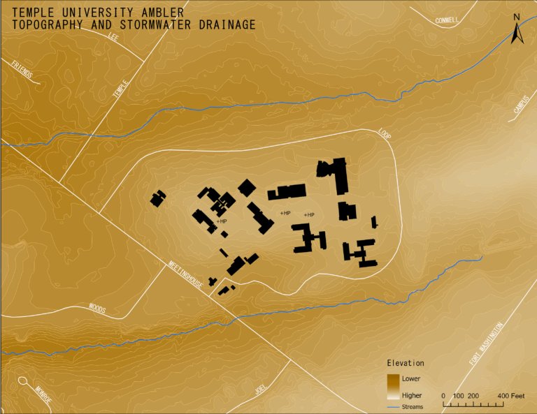
Ambler Campus Inventory and Analysis Maps
For my Design Studio course, I had to complete an analysis of the topography of Temple University Ambler’s Campus. To start off, I made some […]
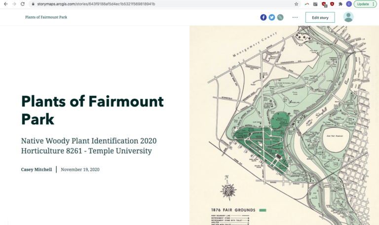
Plants of Fairmount Park
Check out the StoryMap I made of the plants of Fairmount Park for my Native Woody Plant Identification Course! It includes 3 maps: (1) one […]