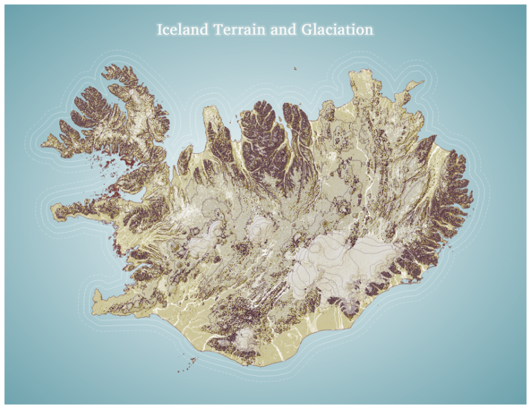
About: I created this visualization using Icelandic terrain and glaciation data for fun in QGIS, drawing inspiration from this tutorial: https://www.esri.com/arcgis-blog/products/3d-gis/3d-gis/hacking-a-dem-sunrise/.
Category: GIS
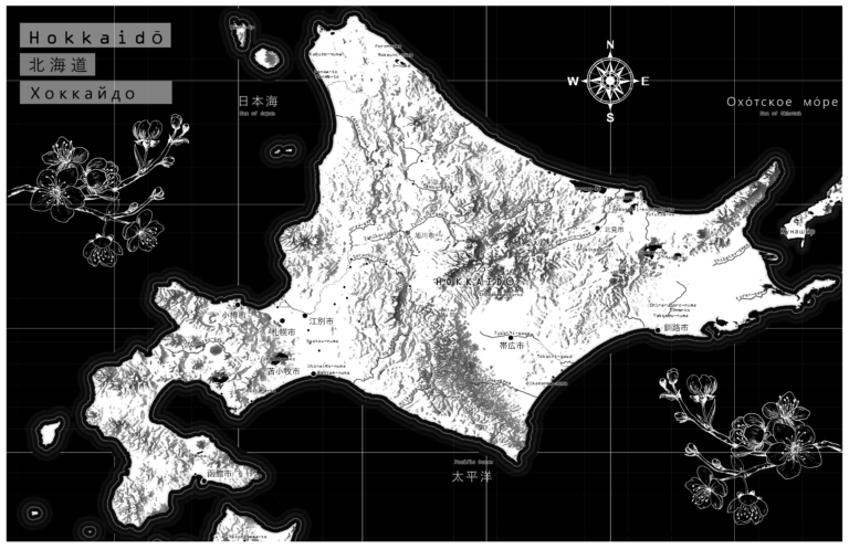
Hokkaido
About: I created this map of Hokkaido and the surrounding Russo-Japanese features for fun in ArcPro. I used design inspiration from this tutorial: https://www.esri.com/arcgis-blog/products/arcgis-pro/mapping/textures-from-basemaps/
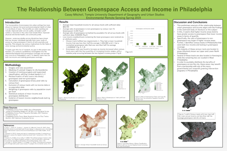
The Relationship Between Greenspace Access and Income in Philadelphia
About: This is my final research project on the relationship between income and greenspace access for my 2019 remote sensing course. Download below for better […]
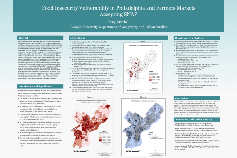
Food Insecurity Vulnerability in Philadelphia and Farmers Markets Accepting SNAP
About: This is my final research project on food insecurity and farmers markets accepting SNAP in Philadelphia for my 2018 Environmental GIS course. Download below […]
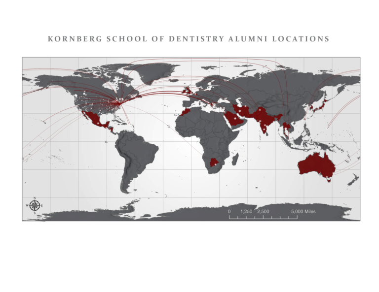
Alumni Locations
About: I created this mock-up for my internship via ArcPro to show the distribution of alumni locations.
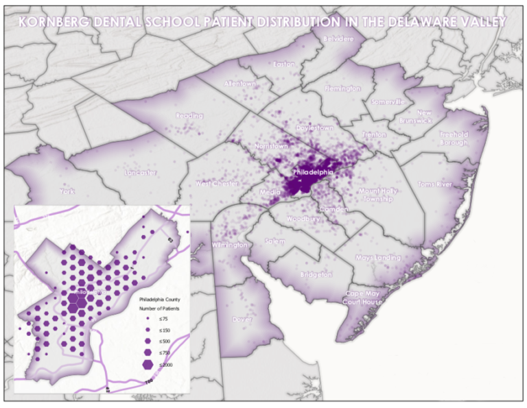
Patient Distribution Map
About: I created this mock-up via ArcPro for my internship to show patient distribution in the Delaware Valley. I followed design principles outlined in this […]
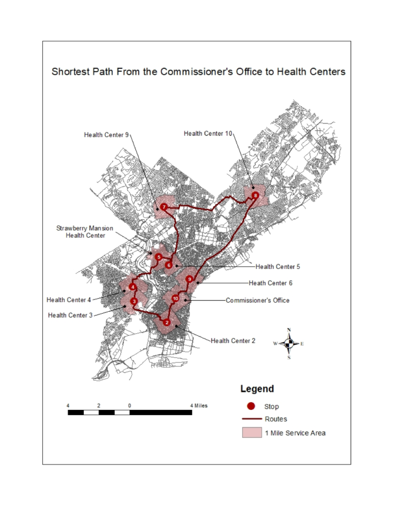
Shortest Path From the Commissioner’s Office to Health Centers
About: I created this map via ArcMap in my 2018 Urban GIS course. The purpose of this lab was to map the distribution of public […]
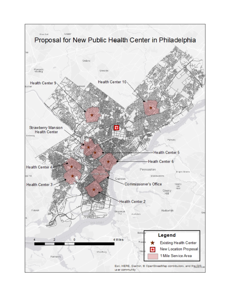
New Public Health Center Proposal
About: I created these maps via ArcMap in my 2018 Urban GIS course. Using geographic methods and the network analyst tool, they propose a logical […]
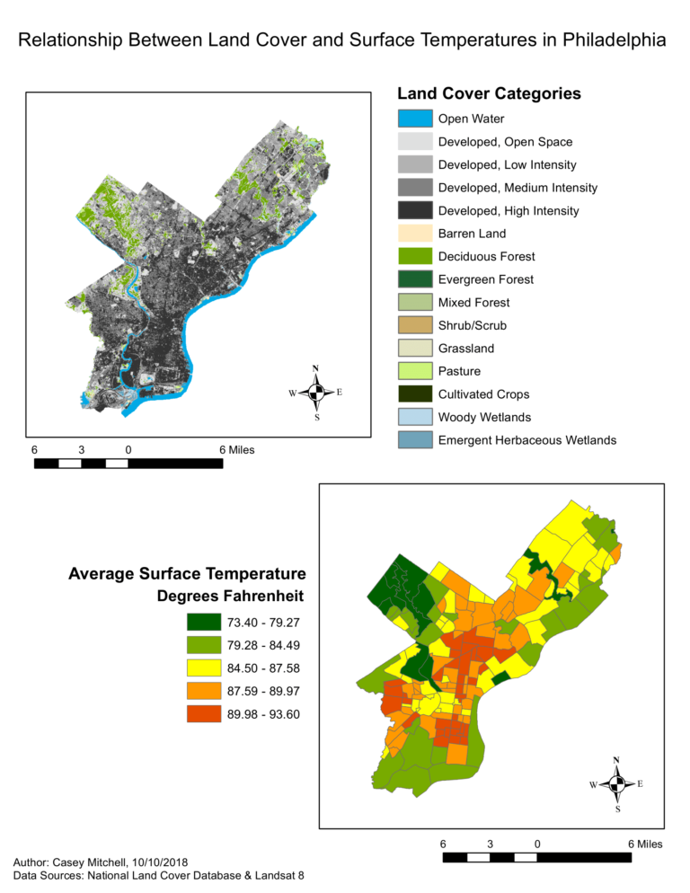
Relationship Between Land Cover and Surface Temperatures in Philadelphia
About: I created this infographic via ArcMap in my 2018 Environmental GIS course in order to compare surface temperature and land cover across the city […]
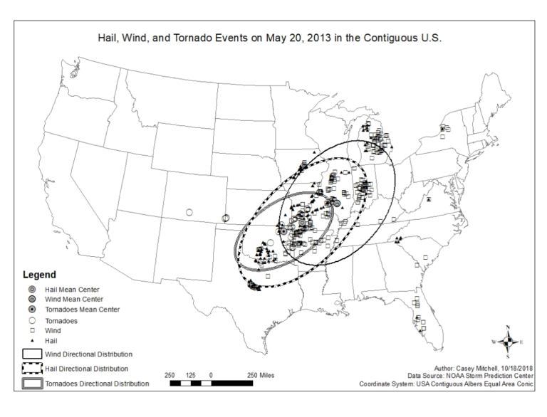
Hail, Wind, and Tornado Events on May 20, 2013
About: I created this map in ArcMap to visualize different weather events in the U.S. on a particular day for my 2018 Environmental GIS Course. […]